
The site is situated on the northern side of the Blyth Valley about 0.5 km. east of Halesworth town centre.
The name Bird’s Folly commemorates the legendary Mr Bird, who owned the pit in the last century (when it had a siding off the main railway line). He thought he was going to make a fortune but we must assume from the name that he failed. It was originally two gravel pits associated with the building of the railway lines. The northern, older pit was possibly used in the construction of the main line railway and is now dominated by mature oak and sycamore woodland and elm scrub. The southern pit is closely associated with the Southwold Light Railway that stopped running in 1929. It contains some important remnants of the railway as well as having developed an interesting mosaic of acid grassland and scrub.
The majority of the site is now part of the Millennium Green having been acquired from Waveney District Council in 2011. The northern part of the older pit is owned by Mr Everitt of Castle House and two other sections are owned by Network Rail. The site has been available for informal public recreation as long as local people can remember.
Wildlife Interest
The site has been designated as a County Wildlife Site particularly for its acid grassland but also for its variety of habitats which includes different types of scrub and secondary woodland. It is one of 104 County Wildlife Sites in Waveney District, only six of which include acid grassland.
The woodland in the northern part of the site has developed since the pit became disused sometime in the middle of the last century. Some of the oaks are over 100 years old and would tend to support this development date. One of the most interesting aspects of this woodland is the strong population of a fern, common polypody that has developed on the north facing pit side. Male fern and buckler fern are also present. The section to the west of the woodland has been affected by Dutch Elm Disease and is now young elm scrub. It seems to be periodically affected by the disease but then vigorously regenerates. Orpine is recorded from this area.
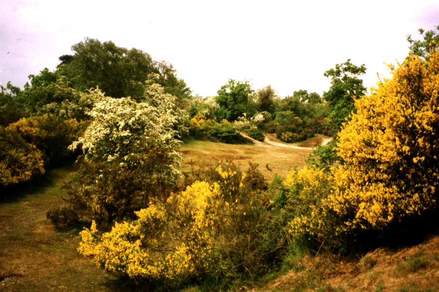
The southern pit area consists of bare ground and moss communities on the old quarry floor with gorse, hawthorn and blackthorn scrub developing on the pit sides and spoil heaps. The sloping area to the east could be the original surface and is dominated by relatively recent scrub, possibly developing post-myxomatosis. The small area of open grassland on this slope contains Ladies Bedstraw, Changing For-get-me-not, Birdsfoot trefoil and Sheep’s Sorrel and other species typical of unimproved acid grassland. It is also a valuable for its invertebrates with both Brown Argus and Green Hairstreak butterflies recorded in recent years.
The mainline and old Southwold railway bridges support black spleenwort and hart’s tongue fern.
29 species of bird have been recorded including Chiff-chaff, Whitethroat, Blackcap, Nightingale, Spotted flycatcher, Green woodpecker, and Great spotted woodpecker.
Reptiles recorded include lizard, slowworm and grass snake.
Historic Interest
All the known historical interest of the site relates to the Southwold Light Railway which provided a narrow gauge passenger and goods service between Halesworth and Southwold from 1879 to 1929. It contains a double arched concrete bridge originally constructed to take the trackway from Holton Road under the main line railway onto the marshes and to take a branch line from the Southwold Railway that was intended to curve through the Folly and then pass through the second arch presumably to provide rail access to the Blyth Navigation which passes through the marshes just the other side of the main line track. This branch line was never built and when the proposals to upgrade the narrow gauge to standard gauge led to the widening of the bridge one arch was filled in and the other arch was widened with brickwork. This arch is still in use as a public footpath and recently repair work has been undertaken to the parapet brickwork. The top of the second concrete arch has been exposed to allow the original form of the bridge to be viewed.
At the eastern end of the Folly are the remains of an Engine Shed built in the early part of the century. It consisted of a wooden frame with asbestos cladding on a concrete base. Only the concrete base survives with its inspection pit and the remains of a well that provided a water supply for the engines. In the autumn of 2015 the Southwold Railway Society undertook work to clear the site and make the remains more visible and further restoration work is planned.
The route of the track between the engine Shed and the Bridge is now a public footpath.
Public Access
Access to the Folly is by public footpath.
Footpath 11 runs through the Folly from the Holton Road under the Southwold Railway bridge to the New Reach and then to the Town Park and the Town centre. Footpath 11 also provides a vehicular track to the Folly however the access off the Holton Road is extremely dangerous for pedestrians and vehicles alike because it is situated on a bend and at the brow of the hill.
Footpath 22 follows the route of the Southwold Railway having been legally diverted following objections from Rail Track to the route that is still shown on the Definitive Map. This path continues along the route of the Railway for another 500 metres following the purchase by Wilfred George and its designation as a public right of way.
Footpath 21 runs along the eastern boundary of the site from the Holton Road to the line of the Railway. It is also a track providing vehicular access.
There is a network of other paths on the site well used by local people and it has long provided a playground for local children. When it snows the Folly provides one of the few sledging slopes in the Town. Youth groups use the Folly for their outdoor activities and it has been used for open-air theatre performances.
The Folly is sometimes used as a site for unregulated parties which result in a noise nuisance late at night, bonfires and a serious litter problem especially broken glass.